Read the article
here.John Little is a R&D Systems Engineer working on flying balloons in new ways to maximize performance and data collection. His current project is setting up a tour of community launches throughout the Western U.S, and our newest launch site in Spokane. Outside of work, he's a folk dance teacher, musician, and bike aficionado.
WindBorne Systems has been experimenting with altitude control and navigation to collect observations closer to the centers of tropical cyclones. Recently, our R&D team successfully conducted flight control trials within Tropical Storm Henriette - they were able to complete viable operational procedures for deploying Global Sounding Balloons (GSBs) into the eyes of developed tropical storms. How you ask? WindBorne balloons can vent and ballast to adjust altitude, and navigate by flying into altitude layers where winds are ideal in order to float in a desired direction. With this technology we were able to navigate two balloons into Tropical Storm Henriette. Both balloons reached the storm's eye wall, descended to the surface, and ascended back to their altitude ceiling before exiting the storm system, collecting critically valuable measurements throughout the process.
The raw data collected near active hurricanes can be disproportionately helpful, since they can help protect millions of people in hurricane-prone areas. Understanding the wind speeds, temperature, pressure, and moisture content around a tropical cyclone (especially near the surface) can help weather models make more accurate predictions about how specific storms will evolve.
It is especially critical to know about intensification and ground track. Will the storm become a category 5 hurricane? Where will it first make landfall? Early answers enable proper emergency planning - allowing governments to coordinate evacuations or adjust strategies if the storm weakens or changes course.
Collecting this data, however, is far from easy. For several decades, NOAA’s Hurricane Hunters have flown crewed missions directly into storms, with pilots and meteorologists operating custom-build aircrafts through dangerous conditions using radar, dropsondes, and other instruments. These highly trained crews, undergo thousands of hours of specialized training to operate safely in these extreme conditions. While these teams successfully gather critical data for understanding storm development, the inherent costs and risks limit the scope of data collection possible. WindBorne aims to help supplement invaluable research, potentially providing compounding benefits for understanding how and where tropical cyclones develop, track, and intensify.
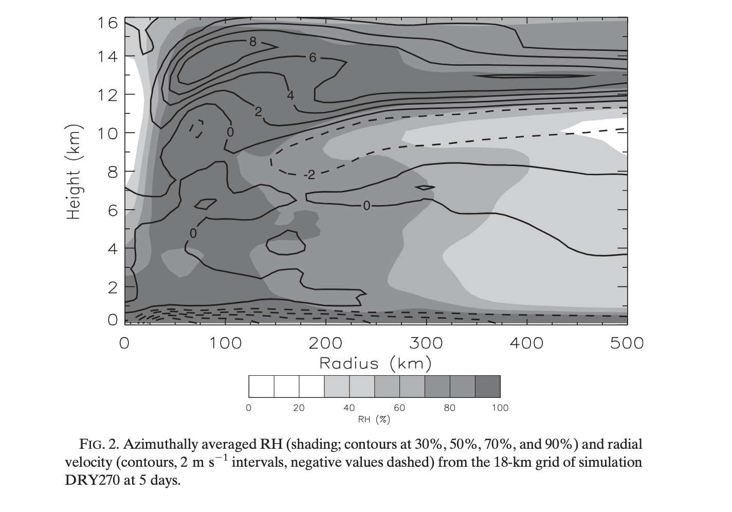
For WindBorne, too, flying into hurricanes is no easy feat! The predominant wind patterns in tropical cyclones create a three-dimensional circulation: surface convergence flows inward toward the center, powerful updrafts occur along the eyewall, and divergence carries air outward in the upper atmosphere. This means surface winds typically transport any air parcel—or balloon—inward toward the center, upward through the eyewall, then outward at altitude. Based on this fundamental understanding of wind flow, a GSB's optimal sampling strategy would be to remain at low altitude near the ocean surface, allowing winds to carry it toward the eye before ascending. However, this flight plan presents significant operational challenges, as the intense precipitation within most tropical cyclone systems could saturate and weigh down a balloon before it reaches its target location.
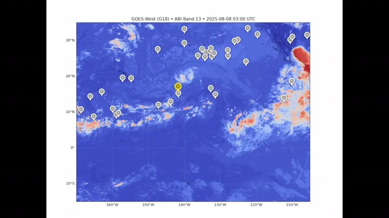
However, we’ve found a way around this limitation. As we’ve flown balloons closer and closer to tropical cyclones, we’ve noticed that there’s a thin layer of convergence in the upper troposphere, between approximately 8 to 10 kilometers in altitude. This region of inflow contains winds that move towards the center of the eye wall, in air which contains much less moisture, which makes for a more viable flight plan. This inflow is also observed in our own WeatherMesh-4 models, and has been noted in recent meteorological journals (Braun et al. 2012; Wang et al. 2020).
We’re excited to showcase the flight plans, satellite overlays, measurements, and commentary about these two missions.
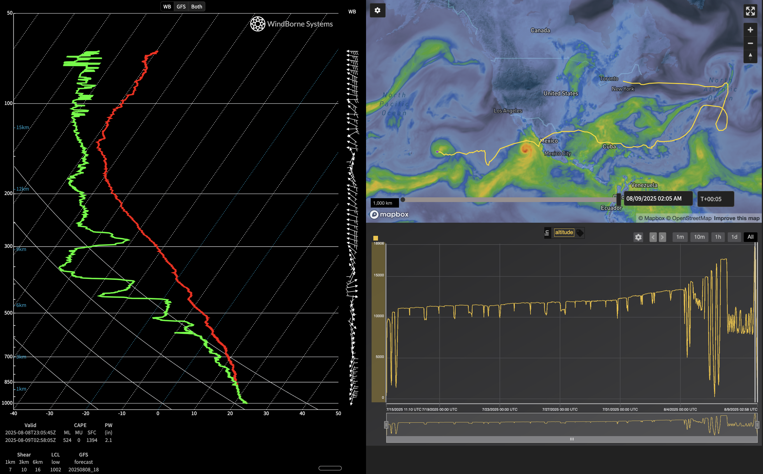
Mission W-3478
August 6th - our first attempt to get close. This balloon, launched from New York, had already flown for about 3 weeks and was near the end of its life (with approximately 11% of its ballast remaining). While tinkering with the altitude control simulations, we noticed low-altitude winds carried it southwest, and high-altitude winds carried it northwest. But there also seemed to be a small band that would intersect with the predicted storm track in approximately 36 hours, so we tried giving it a shot. We set a narrow altitude window between 8km and 10km, and patiently waited as it flew closer and closer. It used about 10% of its ballast, leaving just 1% remaining - about 10 grams of sand! At this point, we removed the altitude restrictions and took one ascent and one final, terminal descent. While this flight didn’t get into the eye of the Hurricane, we were excited that we were able to “chase” the hurricane and take these soundings within the structure.
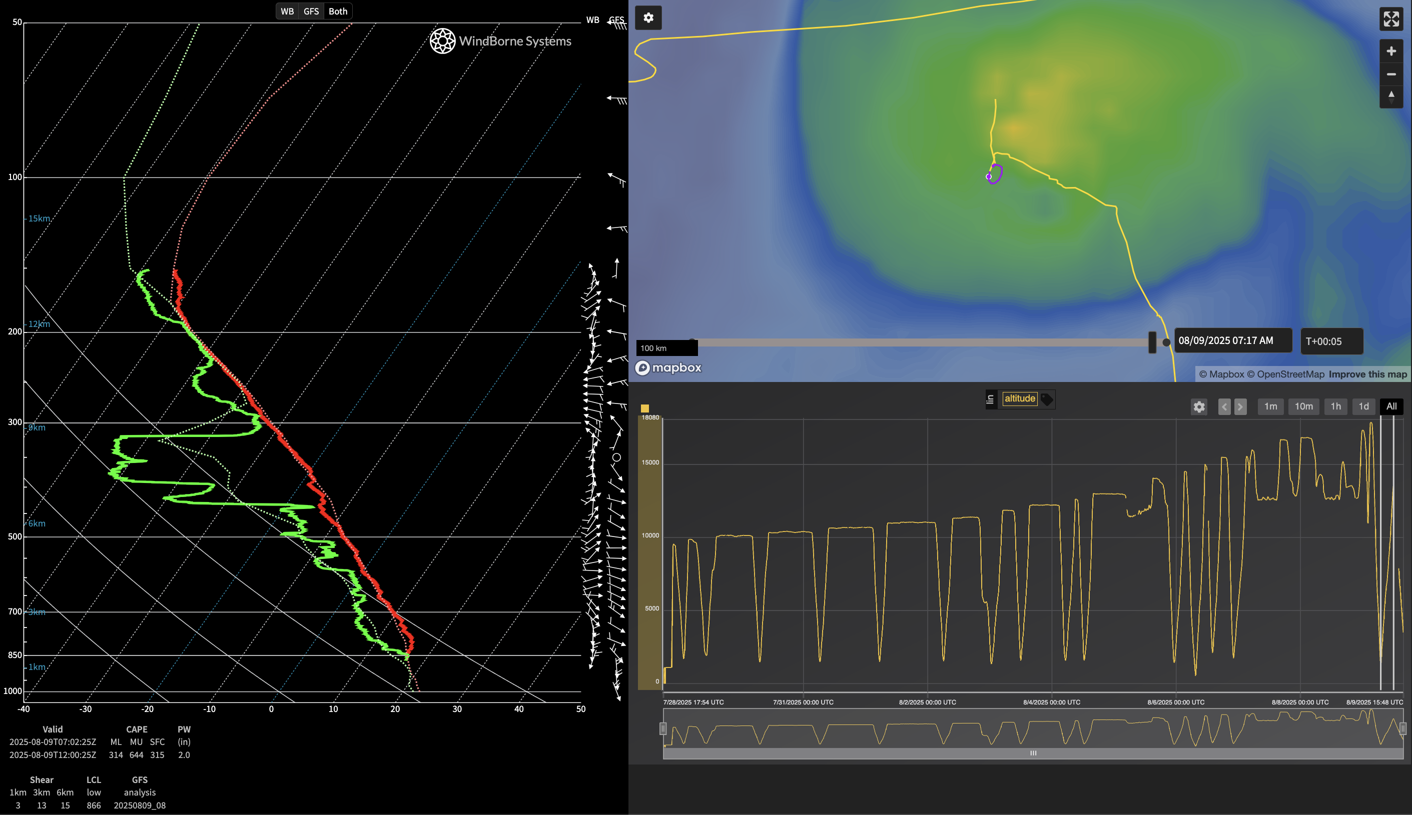
Mission 2 W-3728
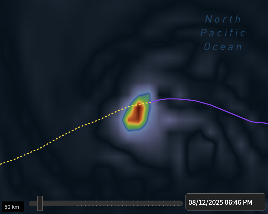
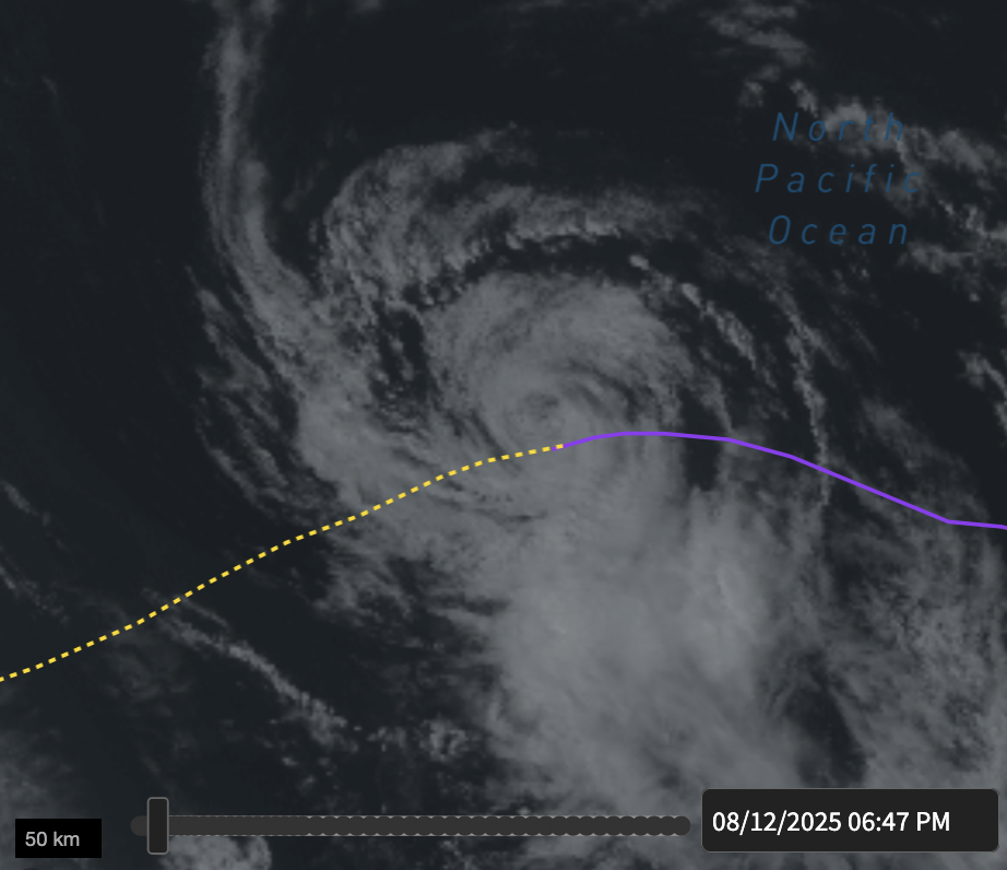
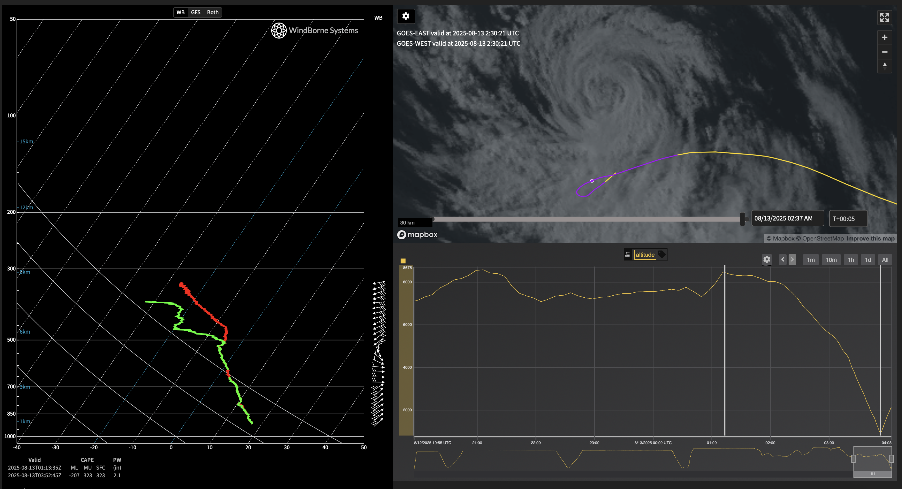
Our next attempt was made by balloon W-3728, which was approaching close behind and had much more ballast remaining. The storm was weakening to a post-tropical cyclone, which also seemed to allow for a wider altitude window - we approached at an altitude of 12 kilometers this time. On the evening of Friday August 8th, we widened the altitude window… when I awoke on Saturday, I checked the balloon to see that it had not only descended from 18km to 1.3km and then ascended to 13.5km in the storm. I looked closer at the soundings we’d taken - during the ascent, it performed two full revolutions within a 25 kilometer radius during its ascent while encountering a drier layer with light winds, bounded vertically by winds in opposite directions. This was a clear sign - we’d transited through the eye of the storm!
Mission W-3894
We were happy with the success of our storm chasing before realizing that a third balloon, launched on August 8th, was approaching towards Henriette as it was strengthening once more. This time, we flew through our tightest, lowest bounds, between 7 km and 8.3 km altitude. When it appeared the flight had reached the center of vorticity on August 13, we increased our bounds and sent the balloon on its descent. It turned around in a 10 kilometer radius and struggled in heavy saturation - it had been ballasting heavily, but ended up landing on the ocean surface, causing electrical shorting in our temperature and humidity sensors. But as the storm moved away and the heavy rains dripped off the balloon, it regained its lift and ascended all the way back up to 13.2 kilometers, taking 3 more soundings of wind speed data in the region before its terminal descent.
Managing these missions requires a lot of attention and finesse since one has to anticipate hazards and execute precise controls to manage each flight. But as WindBorne’s Atlas constellation grows, we’re excited to repeat this methodology to be able to fly through tropical storms and provide extreme weather observations.


